£0.00
World-First Map Exposes Growing Dangers Along Whale Superhighways
A new report from WWF and partners provides the first truly comprehensive look at whale migrations and the threats they face across all oceans, highlighting how the cumulative impacts from industrial fishing, ship strikes, pollution, habitat loss, and climate change are creating a hazardous and sometimes fatal obstacle course for the marine species.
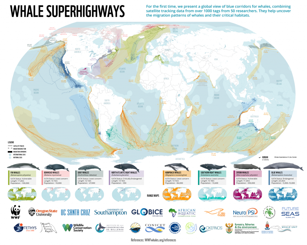
Protecting Blue Corridors, released today by WWF, has for the first time, visualised the satellite tracks of over 1000 migratory whales worldwide. The report outlines how whales are encountering multiple and growing threats in their critical ocean habitats – areas where they feed, mate, give birth, and nurse their young – and along their migration superhighways, or ‘blue corridors’.
“Cumulative impacts from human activities – including industrial fishing, ship strikes, chemical, plastic and noise pollution, habitat loss, and climate change – are creating a hazardous and sometimes fatal obstacle course,” said Chris Johnson, Global Lead for whale and dolphin conservation at WWF. “The deadliest by far is entanglement in fishing gear – killing an estimated 300,000 whales, dolphins, and porpoises each year. What’s worse, this is happening from the Arctic to the Antarctic.”[1]
Click here to read more…